REVEALED: Air pollution hot spots in Sheffield where deadly fumes are more than twice legal limit


Dangerously high levels of nitrogen dioxide have been recorded around the city as part of a community monitoring scheme.
The concentration of the noxious gas breaches the European Union threshold of 40 micograms per cubic metre at dozens of sites across Ecclesall, Crookes, Darnall, Tinsley and other areas.
Advertisement
Hide AdAdvertisement
Hide Ad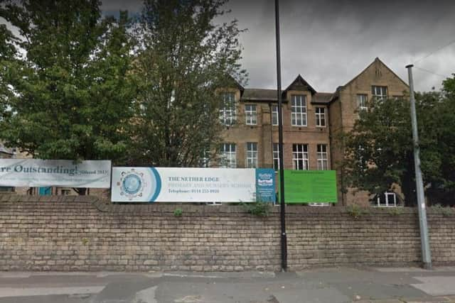
Those include primary schools in Nether Edge, where pupils are breathing in a harmful soup of smog on a daily basis.
The most polluted spot is at Sheffield station, where all 14 monitors recorded illegal levels of the toxin.
At the station's taxi rank, over 100 micograms of NO2 per cubic metre was found, and at platform 3A/2B, the level was more than 90μg/m3.
The latest readings, published at the beginning of May, were taken from monitors placed across Sheffield as part of the East End Quality of Life Initiative.
Advertisement
Hide AdAdvertisement
Hide AdThey show average NO2 levels at numerous locations during the first three months of this year.
Air pollution causes an estimated 500 premature deaths in Sheffield each year, according to Sheffield Friends of the Earth.
John Mothersole, chief executive of Sheffield Council, said: "Air quality is a major national problem. We realise this is an issue in Sheffield and are 100 per cent committed to tackling it. Our city is changing rapidly and we must improve air quality for all our residents.
"We have already taken action where necessary. Our recently-published sustainability vision also shows our commitment to improving air quality and creating a sustainable and integrated transport system that supports the city’s growth ambitions.
Advertisement
Hide AdAdvertisement
Hide Ad"We welcome the Government’s announcement and, together with the other cities named in this report, will now study the implications for Sheffield and the wider region."
The council's sustainability plan, approved in March, set out five priorities including reducing air pollution to a point 'well below' the EU limit.
To achieve this, it recommended shifting away from diesel vehicles to those powered by electricity, gas and other more sustainable sources of energy.
SHEFFIELD'S MOST POLLUTED SPOTS (areas where average nitrogen dioxide levels exceed EU limit)
Advertisement
Hide AdAdvertisement
Hide AdABBEYDALE ROAD CORRIDORButterworth Cycles, S7 1TAAbbeydale Road/Carterknowle RoadAbbeydale Road, S7 2BHChippendale, Abbeydale Road/Archer Road S7 2BJLa Scala, Abbeydale RoadAbbeydale Road South/Abbey Lane
CROOKES AND BROOMHILLCrookes Road (opp Hoole Road) S10 5BBNewbould Lane/Watson RoadManchester Road/Fulwood Road junction
DARNALLShop Front Parkway R/A S9 4AE
ECCLESALL (January and February only)Books on the Park S11 8TGEcclesall Fisheries (over 50)
HILLSBOROUGH/MALIN BRIDGE/WALKLEYWalkley Road/South Road (March only) (over 50)
KELHAM ISLANDWickerLady's BridgePenistone Road
NETHER EDGENether Edge SchoolHolt House School
Advertisement
Hide AdAdvertisement
Hide AdPENISTONE ROADPenistone Road/Bickerton RoadCatchbar Lane traffic lightWinster RoadPenistone Road/Dixon Lane
SHEFFIELD HALLAM UNIVERSITYSheaf Street 2Sheaf Street station sideStation taxi rank 1Station taxi rank 2Fitzalan Square
SHEFFIELD STATION14 monitors all exceed legal cap
TINSLEY FORUMTown StreetSiemens Close (M1 end)Old Tinsley Infants School